Marking a year since the publication of ‘A Suitable Stone' gives an opportunity to celebrate the work of illustrator Fiona Boyd who is part of the Cardoso Kindersley workshop. I provided geological diagrams created on the computer which Fiona turned into illustrations by hand drafting, lettering and colouring.
It is striking how hand-drawn illustrations make the geology sing. For example, Lucy Williams’ review in Geoscientist says: ‘This book is exquisitely illustrated; the simple yet informative illustrations by Fiona Boyd are refreshing and bring to life maps, cross sections, and charts that will be familiar to geological readers, but here entice you to examine with fresh eyes.’
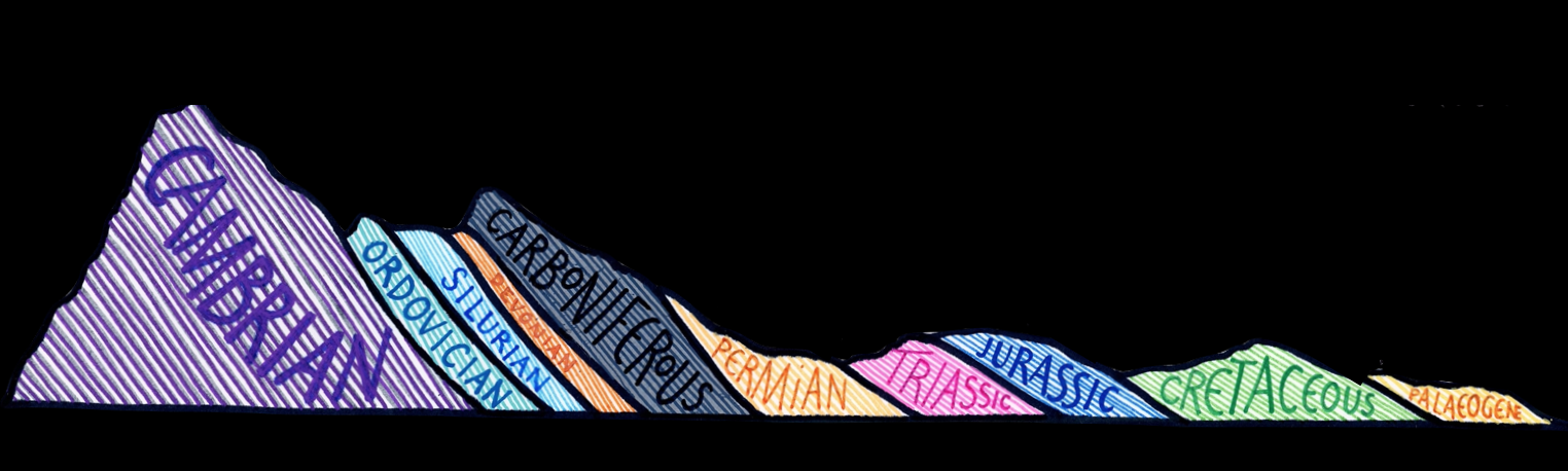
A tabulated geological time scale illustrates British ‘suitable stones’ used for letter cutting and their main source quarries. Small cartoons show creatures as the victims of mass extinctions - or in the case of humans, as the cause. This provides an opportunity for dialogue about different perceptions of time scales - for the letter cutter hundreds or thousands of years, for the geologist millions or billions of years. The workshop clock face with the Earth’s history shown as twelve hours highlights the extent of the Precambrian before the suitable stones were formed.
A geological map of Britain with outlines for the sedimentary, volcanic and slatey strata was built using the BGS tool ‘Make a Map’. The main ‘suitable stones’ are in bold colour with the other stones shaded in and quarries are highlighted as stars. A prominent band of blue Jurassic limestone (e.g. Portland stone) crosses England. The main Scottish geological structures are shown with igneous and metamorphic rocks but few ‘suitable stones’ north of the border.
A cross-section mirrors the one accompanying William Smith’s map, both as a homage to Smith as a great illustrator, and to show how in England and Wales the rocks generally become younger on a traverse from northwest to southeast.
Cartoons illustrate the geological processes contributing to the formation of the stones. These attempt to show a geological cycle. Deep water deposition is followed by volcanism during closure of oceans. Uplift and erosion of sandstones follows continental collision. Sea level rises the land subsides as limestones are deposited in tropical conditions.
For those interested in further delving into geological illustration, a history of drawings stretching back to Leonardo da Vinci is given on YouTube by Earth scientist and illustrator Vojta Hýbl. Another current geological illustrator is Lucía Pérez-Díaz whose work invites us to consider ‘How the Earth Works’ or to travel to time periods such as the Cambrian to ‘Explore an alien world without leaving Earth’.
From my own experience, I have seen how Fiona’s work is a powerful example of how illustration and lettering can bring our stories of the Earth to life.
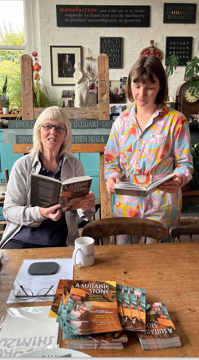
Lida Lopez Cardoso Kindersley and Fiona Boyd
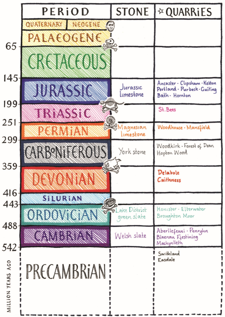
A geological time scale
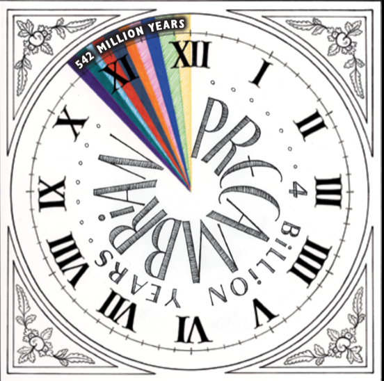
The age of the Earth on a twelve hour clockface
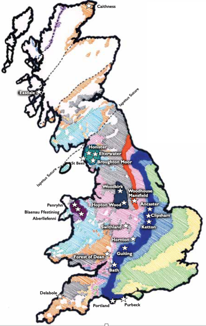
A geological map of Britain with ‘suitable stones’
A cross-section across Wales and England
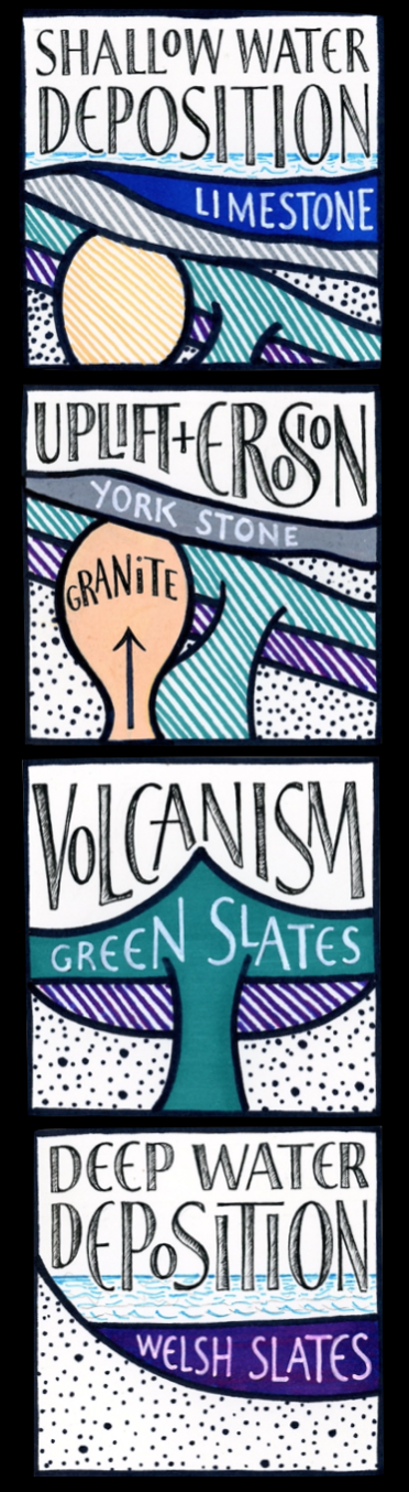
Cartoons of geological processes creating the ‘suitable stones’
A Suitable Stone: How geology has shaped the British stones used for letter cutting and fine carving
https://stevegarrettguitar.com/a-suitable-stone
https://www.kindersleyworkshop.co.uk/shop/p/a-suitable-stone-pre-publication
A Suitable Stone: Geoscientist review
https://geoscientist.online/sections/books-and-arts/a-suitable-stone/
Fiona Boyd
https://www.instagram.com/feeownahboyd
British Geological Survey map maker
https://www2.bgs.ac.uk/discoveringGeology/geologyOfBritain/makeamap/map.html
Putting Rocks on Paper: The Art of Geological Illustration
Putting Rocks on Paper: The Art of Geological Illustration
Vojta Hýbl
https://vojtahybl.com/
Draw them in: the art of geoscience communication through illustration
https://geoscientist.online/sections/unearthed/draw-them-in/
Lucía Pérez-Díaz
https://www.luciaperezdiaz.com/